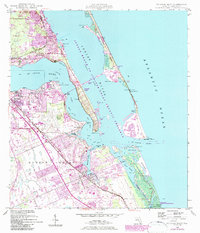
1948 Map of St. Lucie Inlet
USGS Topo · Published 1983About this map
Stuart and Port Salerno anchor this coastal landscape where the St Lucie River and Indian River converge to meet the Atlantic Ocean. The geography of the late 1940s is defined by sprawling Spanish land grants, including the Hanson Grant and Gomez Grant, which reflect the region's colonial heritage. Significant post-war developments like the aviation facilities at Witham Field and the expansion of communities such as Port Sewall and Sewalls Point indicate a shift toward modern growth along the barrier islands and waterfront. The rail-connected economy is traced via the Florida East Coast line, while the preservation of natural stretches is evident at the Savannas State Preserve and the southern edge of the Hobe Sound National Wildlife Refuge. Coastal navigation is detailed through markers like the St Lucie Inlet and the sheltered waters of the Jensen Beach to Jupiter Inlet Aquatic Preserve.
Find a feature on this map
59 named features on this map. Tap any name to fly to it.
Don’t see what you’re looking for? This feature index may not catch every label — zoom into the map to look around manually.
Map Details
Editions of this 1948 St. Lucie Inlet Map
4 editions found
Other maps of this area

1948 · Palm City
USGS Topo · 1:24,000

1948 · Ankona
USGS Topo · 1:24,000

1948 · St. Lucie Inlet
USGS Topo · 1:24,000

1948 · Gomez
USGS Topo · 1:24,000

1948 · Hobe Sound
USGS Topo · 1:24,000

1948 · Eden
USGS Topo · 1:24,000

1949 · Gomez
USGS Topo · 1:24,000

1949 · Hobe Sound
USGS Topo · 1:24,000

1950 · St. Lucie Inlet
USGS Topo · 1:24,000

1950 · Ankona
USGS Topo · 1:24,000