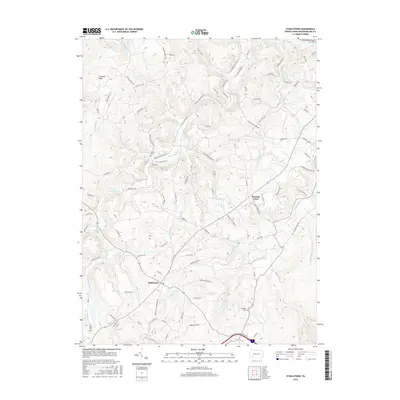
2016 Map of Stahlstown
USGS Topo · Published 2016About this map
Stahlstown and the surrounding Ligonier Valley landscape are defined by the prominent height of Chestnut Ridge and a network of winding mountain runs. This 2016 survey of Westmoreland County captures the transition between these steep ridges and the drainage basins of Loyalhanna Cr and Fourmile Run. Local history is anchored by rural burial grounds including Bethel Cem, Snowball Cem, and Porch Cem, which sit alongside a complex web of named roads like Hoods Mill Rd and Jones Mills Stahlstown Rd. The area's settlement pattern reflects its geographic isolation, with small communities like Pleasant Grove situated near the intersection of various creeks and traditional family-named lanes. From the waters of Breskin Pond to the secluded drainage of Powdermill Run, the map documents a terrain where modern secondary highways still follow the contours of the historic Appalachian foothills.
Find a feature on this map
94 named features on this map. Tap any name to fly to it.
Don’t see what you’re looking for? This feature index may not catch every label — zoom into the map to look around manually.
Map Details
Editions of this 2016 Stahlstown Map
This is the sole edition of this map. No revisions or reprints were ever made.
Other maps of this area

1900 · Latrobe
USGS Topo · 1:62,500

1902 · Latrobe
USGS Topo · 1:62,500

1903 · Latrobe
USGS Topo · 1:62,500

1913 · Somerset
USGS Topo · 1:62,500

1915 · Somerset
USGS Topo · 1:62,500

1920 · New Florence
USGS Topo · 1:62,500

1921 · New Florence
USGS Topo · 1:48,000

1922 · Donegal
USGS Topo · 1:62,500

1922 · New Florence
USGS Topo · 1:62,500

1935 · Donegal
USGS Topo · 1:62,500
Featured Places
- Donegal Township, PA
- Stahlstown, Cook Township
- Mansville, Cook Township
- Unity Township, PA
- Pleasant Grove, Cook Township