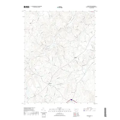
2019 Map of Stahlstown
USGS Topo · Published 2019About this map
Stahlstown and Pleasant Grove serve as the primary focal points in this Westmoreland County landscape, defined by the prominent elevation of Chestnut Ridge. The terrain is deeply etched by a dense network of watercourses including Loyalhanna Cr, White Oak Run, and Fourmile Run, which dictate the winding paths of local roads. This late 2010s survey illustrates a region where rural residential life is interspersed with historical markers, such as Bethel Cem and Snowball Cem. The drainage patterns toward Breskin Pond and the presence of names like Distillery Rd and Fort Hill RD suggest a long history of local industry and strategic positioning within the Ligonier Valley. The map captures the modern footprint of these communities while preserving the traditional nomenclature of the hollows and runs.
Find a feature on this map
97 named features on this map. Tap any name to fly to it.
Don’t see what you’re looking for? This feature index may not catch every label — zoom into the map to look around manually.
Map Details
Editions of this 2019 Stahlstown Map
This is the sole edition of this map. No revisions or reprints were ever made.
Other maps of this area

1900 · Latrobe
USGS Topo · 1:62,500

1902 · Latrobe
USGS Topo · 1:62,500

1903 · Latrobe
USGS Topo · 1:62,500

1913 · Somerset
USGS Topo · 1:62,500

1915 · Somerset
USGS Topo · 1:62,500

1920 · New Florence
USGS Topo · 1:62,500

1921 · New Florence
USGS Topo · 1:48,000

1922 · Donegal
USGS Topo · 1:62,500

1922 · New Florence
USGS Topo · 1:62,500

1935 · Donegal
USGS Topo · 1:62,500
Featured Places
- Donegal Township, PA
- Stahlstown, Cook Township
- Mansville, Cook Township
- Unity Township, PA
- Pleasant Grove, Cook Township