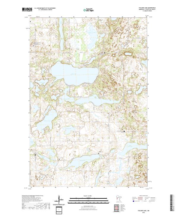
2022 Map of Stalker Lake
USGS Topo · Published 2022About this map
Stalker Lake and its surrounding wetlands form the center of this rural landscape in Otter Tail County, where numerous water bodies like Jewell Lake, Lacey Lake, and Tamarack Lake characterize the glacial topography. The distribution of family and community heritage is evident in the cluster of burial grounds, such as the Evangelical Lutheran Rolling Prairie Congregational Cem and the Jordenskjold Free Mission Church Cem. These sites, along with the Saint Olaf Cem and Kvam Cem, reflect the Scandinavian and Northern European settlement patterns common to this part of Minnesota. The Pomme de Terre River and Pelican Creek weave through the township divisions of t132n r41w and t131n r41w, connecting the diverse aquatic ecosystems. The road network, including Co Hwy 119 and Co Hwy 39, provides access to these lakefront properties and agricultural sections.
Find a feature on this map
81 named features on this map. Tap any name to fly to it.
Don’t see what you’re looking for? This feature index may not catch every label — zoom into the map to look around manually.
Map Details
Editions of this 2022 Stalker Lake Map
This is the sole edition of this map. No revisions or reprints were ever made.
Other maps of this area

1912 · Battle Lake
USGS Topo · 1:62,500

1913 · Ashby
USGS Topo · 1:62,500

1914 · Battle Lake
USGS Topo · 1:62,500

1915 · Underwood
USGS Topo · 1:62,500

1953 · Brainerd
USGS Topo · 1:250,000

1957 · Brainerd
USGS Topo · 1:250,000

1958 · Brainerd
USGS Topo · 1:250,000

1965 · Brainerd
USGS Topo · 1:250,000

1969 · Eagle Lake
USGS Topo · 1:24,000
1969 · Evansville
USGS Topo · 1:24,000
Featured Places
- Clitherall Township, MN
- Eagle Lake Township, MN
- Saint Olaf Township, MN
- Tordenskjold Township, MN
- Otter Tail County, MN