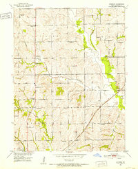
1951 Map of Standish
USGS Topo · Published 1952About this map
The ridge country of Van Horn Ridge dominates this 1951 snapshot of rural Carroll County, where small-scale agricultural life is recorded at a point of significant transition. While the settlement of Standish remains a focal point in the southeast, the landscape is dotted with numerous one-room schoolhouses marked as abandoned, such as Van Horn Sch, North Baker Sch, and Taylor Sch. This pattern suggests the consolidation of rural education districts that occurred mid-century.
Find a feature on this map
25 named features on this map. Tap any name to fly to it.
Don’t see what you’re looking for? This feature index may not catch every label — zoom into the map to look around manually.
Map Details
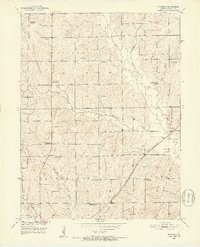
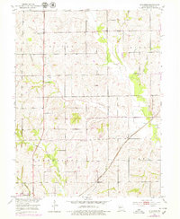
Editions of this 1951 Standish Map
3 editions found
Other maps of this area

1889 · Lexington
USGS Topo · 1:125,000

1890 · Marshall
USGS Topo · 1:125,000

1892 · Marshall
USGS Topo · 1:125,000

1901 · Marshall
USGS Topo · 1:125,000

1924 · Dawn
USGS Topo · 1:62,500

1924 · Hale
USGS Topo · 1:62,500

1950 · Coloma
USGS Topo · 1:24,000

1950 · Hale
USGS Topo · 1:24,000

1951 · Hale
USGS Topo · 1:24,000

1951 · Bosworth
USGS Topo · 1:24,000