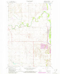
1968 Map of Stanton
USGS Topo · Published 1981About this map
Stanton sits at the confluence of the Knife River and the Missouri R in this late 1960s topographical survey, later updated to reflect changes through the 1970s. The landscape is defined by the sharp meanders of the Knife River, where its floodplains meet the higher plateaus. A significant portion of the northern riverbank is preserved as the Knife River Indian Village National Historic Site, marking a place of deep indigenous history along the river's edge.
Find a feature on this map
18 named features on this map. Tap any name to fly to it.
Don’t see what you’re looking for? This feature index may not catch every label — zoom into the map to look around manually.
Map Details
Editions of this 1968 Stanton Map
2 editions found
Other maps of this area

1948 · Stanton
USGS Topo · 1:62,500

1949 · Stanton
USGS Topo · 1:62,500

1954 · McClusky
USGS Topo · 1:250,000

1958 · McClusky
USGS Topo · 1:250,000

1967 · Stanton SE
USGS Topo · 1:24,000

1968 · Hannover NE
USGS Topo · 1:24,000

1968 · Red Butte
USGS Topo · 1:24,000

1968 · Stanton
USGS Topo · 1:24,000

1968 · Hannover NW
USGS Topo · 1:24,000

1968 · Hazen East
USGS Topo · 1:24,000