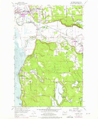
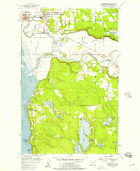
1956 Map of Stanwood
USGS Topo · Published 1976About this map
Stillaguamish River and its intricate distributaries, including Irvine Slough, Hat Slough, and South Slough, dominate this coastal Washington landscape. The twin settlements of Stanwood and East Stanwood serve as the northern hubs, connected by the Burlington Northern railroad and proximity to the Twin City High Sch. The region's geography is defined by the transition from the fertile lowlands near Silvana and Norman to the elevated terrain of Silvana Terraces and Happy Valley. In the south, the landscape is dotted with several freshwater bodies, most notably Goodwin Lake, home to Wenberg State Park, and Lake Shoecraft. Along the shoreline of Port Susan, the recreational and residential areas of Warm Beach and McKees Beach provide a record of mid-century coastal development, while localized industry is evidenced by numerous Gravel Pits scattered throughout the higher ground.
Find a feature on this map
59 named features on this map. Tap any name to fly to it.
Don’t see what you’re looking for? This feature index may not catch every label — zoom into the map to look around manually.
Map Details
Editions of this 1956 Stanwood Map
5 editions found
Other maps of this area

1911 · Mount Vernon
USGS Topo · 1:125,000

1940 · Mt Vernon
USGS Topo · 1:62,500

1941 · Marysville
USGS Topo · 1:62,500

1943 · Marysville
USGS Topo · 1:62,500

1943 · Mt Vernon
USGS Topo · 1:62,500

1943 · Stanwood
USGS Topo · 1:62,500

1944 · Clear Lake
USGS Topo · 1:62,500

1956 · Tulalip
USGS Topo · 1:24,000

1956 · Arlington West
USGS Topo · 1:24,000
1956 · Stanwood
USGS Topo · 1:24,000