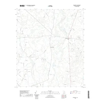
2020 Map of Statenville
USGS Topo · Published 2020About this map
Statenville serves as the focal point for this section of South Georgia, where the Echols County Courthouse marks the seat of local administration. The landscape is defined by the winding paths of the Alapaha River and its tributary, the Alapahoochee River, which cut through a network of rural routes named for local families and agricultural sites. Numerous family and community landmarks are scattered across the terrain, such as Carter Cem and roads leading to historic congregational sites like Sardis Church Rd and Bethel Church Rd. The map illustrates a contemporary rural infrastructure where large land tracts are accessed via named lanes like J Frank Culpepper Rd and Coggins Farm Rd, reflecting the region's enduring connection to timber and farming. These wetlands and creek systems, including Alligator Cr and Knights Br, influence the drainage patterns of this coastal plain environment.
Find a feature on this map
69 named features on this map. Tap any name to fly to it.
Don’t see what you’re looking for? This feature index may not catch every label — zoom into the map to look around manually.
Map Details
Editions of this 2020 Statenville Map
This is the sole edition of this map. No revisions or reprints were ever made.
Other maps of this area

1954 · Valdosta
USGS Topo · 1:250,000

1955 · Jasper
USGS Topo · 1:24,000

1956 · Jennings
USGS Topo · 1:24,000

1956 · Octahatchee
USGS Topo · 1:24,000

1958 · Valdosta
USGS Topo · 1:250,000

1959 · Valdosta
USGS Topo · 1:250,000

1971 · Indianola
USGS Topo · 1:24,000

1971 · Howell
USGS Topo · 1:24,000

1971 · Lake Park
USGS Topo · 1:24,000

1971 · Tarver
USGS Topo · 1:24,000