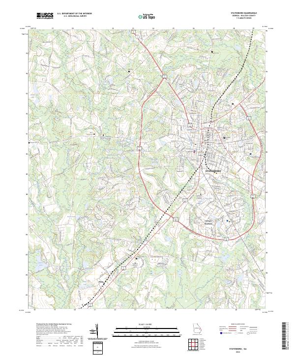
1920 Map of Statesboro
USGS Topo · Published 1920About this map
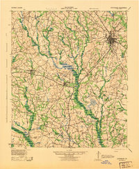
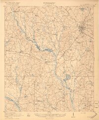
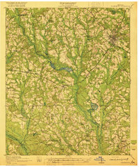
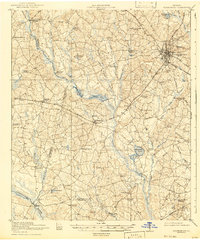
Statesboro serves as the regional hub for eastern Georgia in this post-World War I era survey, situated at the junction of the Central of Georgia and Shearwood Railway. The surrounding landscape of Bulloch County is defined by a dense network of rural infrastructure, where nearly every crossroads is anchored by a neighborhood institution such as Langston Chapel, Smith Allen Deal School, or Byrd School. The topography is characterized by a series of significant water bodies and swamps, including Riggs Pond and Kennedy Pond, which feed into the Canoochee River in the southwestern corner. The mapping detail reveals a transition from the town center to a countryside punctuated by small settlements like Register and Adabelle, connected by early thoroughfares like the Savannah and Statesboro Road.
Find a feature on this map
67 named features on this map. Tap any name to fly to it.
Don’t see what you’re looking for? This feature index may not catch every label — zoom into the map to look around manually.
Map Details
Editions of this 1920 Statesboro Map
4 editions found

Historical Maps of Statesboro Through Time
9 maps found