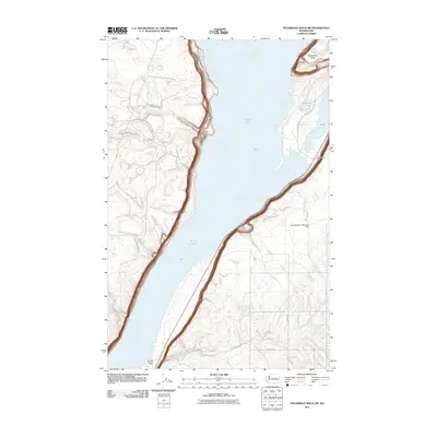
2011 Map of Steamboat Rock SW
USGS Topo · Published 2011About this map
Banks Lake dominates this Grant County landscape, showing the vast reservoir's western reaches as they appeared in 2011. The prominent geological formation of Steamboat Rock stands at the northern edge of the sheet, surrounded by the waters of the lake and neighboring Thompson Lake. The map reveals a transition from the water's edge to the high desert terrain of the Coulee region, characterized by drainage systems like Rusho Creek and Ladds Creek. To the southeast, the Higginbotham Reservoir Dam controls local irrigation and water flow, reflecting the area's agricultural infrastructure. Modern recreation is evidenced by the Poplar Picnic Area and the winding Steamboat Rock Park Entrance Rd, providing a detailed look at the infrastructure supporting visitors to this unique basalt plateau.
Find a feature on this map
14 named features on this map. Tap any name to fly to it.
Don’t see what you’re looking for? This feature index may not catch every label — zoom into the map to look around manually.
Map Details
Editions of this 2011 Steamboat Rock SW Map
This is the sole edition of this map. No revisions or reprints were ever made.
Other maps of this area

1930 · Grand Coulee Sheet 3
USGS Topo · 1:31,680

1953 · Ritzville
USGS Topo · 1:250,000

1959 · Ritzville
USGS Topo · 1:250,000

1965 · Ritzville
USGS Topo · 1:250,000

1965 · Mold
USGS Topo · 1:24,000

1968 · Steamboat Rock SW
USGS Topo · 1:24,000

1968 · Barker Canyon
USGS Topo · 1:24,000

1968 · Hartline
USGS Topo · 1:24,000

1968 · Foster Coulee
USGS Topo · 1:24,000

1968 · Steamboat Rock SE
USGS Topo · 1:24,000