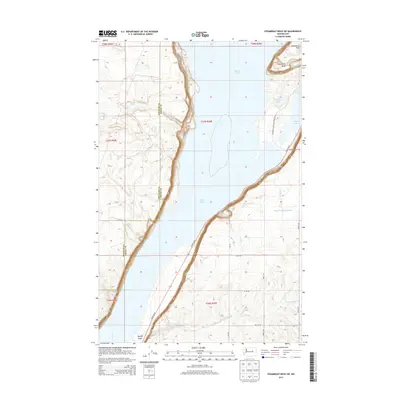
2014 Map of Steamboat Rock SW
USGS Topo · Published 2014About this map
Banks Lake dominates the central topography of this 2014 survey, illustrating the vast engineered water system of the Grand Coulee area. The massive plateau of Steamboat Rock rises prominently in the northeast, a geological landmark that defines the local landscape and serves as the centerpiece for the Steamboat Rock Park Entrance Rd. The terrain is marked by sharp elevation changes between the high desert plateaus of Douglas Co and the reservoir basin in Grant Co.
Find a feature on this map
25 named features on this map. Tap any name to fly to it.
Don’t see what you’re looking for? This feature index may not catch every label — zoom into the map to look around manually.
Map Details
Editions of this 2014 Steamboat Rock SW Map
This is the sole edition of this map. No revisions or reprints were ever made.
Other maps of this area

1930 · Grand Coulee Sheet 3
USGS Topo · 1:31,680

1953 · Ritzville
USGS Topo · 1:250,000

1959 · Ritzville
USGS Topo · 1:250,000

1965 · Ritzville
USGS Topo · 1:250,000

1965 · Mold
USGS Topo · 1:24,000

1968 · Steamboat Rock SW
USGS Topo · 1:24,000

1968 · Barker Canyon
USGS Topo · 1:24,000

1968 · Hartline
USGS Topo · 1:24,000

1968 · Foster Coulee
USGS Topo · 1:24,000

1968 · Steamboat Rock SE
USGS Topo · 1:24,000