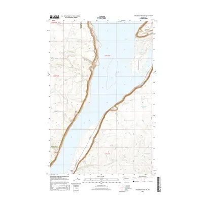
2017 Map of Steamboat Rock SW
USGS Topo · Published 2017About this map
Banks Lake dominates the central coulee of this Grant County landscape, providing a clear view of the mid-20th-century irrigation and recreation infrastructure in eastern Washington. The sheer basaltic profile of Steamboat Rock stands as a massive landmark in the northeast, while smaller water bodies like Thompson Lake and Higginbotham Reservoir dot the surrounding high desert terrain. The map details the local road network, including Coulee Blvd and the Steamboat Rock Park Entrance Rd, which provide access to the water's edge and the surrounding plateau. Subtle drainage patterns such as Paynes Gulch, Rusho Cr, and Lower Lewis Cr reveal the complex hydrology of the Grand Coulee area. The boundary between Douglas Co and Grant Co is clearly demarcated, showing how these political lines intersect with the dramatic natural features of the Columbia Basin.
Find a feature on this map
23 named features on this map. Tap any name to fly to it.
Don’t see what you’re looking for? This feature index may not catch every label — zoom into the map to look around manually.
Map Details
Editions of this 2017 Steamboat Rock SW Map
This is the sole edition of this map. No revisions or reprints were ever made.
Other maps of this area

1930 · Grand Coulee Sheet 3
USGS Topo · 1:31,680

1953 · Ritzville
USGS Topo · 1:250,000

1959 · Ritzville
USGS Topo · 1:250,000

1965 · Ritzville
USGS Topo · 1:250,000

1965 · Mold
USGS Topo · 1:24,000

1968 · Steamboat Rock SW
USGS Topo · 1:24,000

1968 · Barker Canyon
USGS Topo · 1:24,000

1968 · Hartline
USGS Topo · 1:24,000

1968 · Foster Coulee
USGS Topo · 1:24,000

1968 · Steamboat Rock SE
USGS Topo · 1:24,000