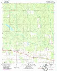
1980 Map of Steelwood Lake
USGS Topo · Published 1986About this map
Steelwood Lake lies at the heart of this landscape, fed by Roans Creek and surrounded by a complex network of waterways including Juniper Creek and Flat Creek. The terrain is defined by the southeasterly flow of the Styx River and the Blackwater River, which carve through the woodland and agricultural plots of central Baldwin County. This 1980s record captures the region’s rural infrastructure, from the small community of Loxley in the southwest corner to the Rosinton Ch and Styx River Ch.
Find a feature on this map
23 named features on this map. Tap any name to fly to it.
Don’t see what you’re looking for? This feature index may not catch every label — zoom into the map to look around manually.
Map Details
Editions of this 1980 Steelwood Lake Map
2 editions found
Other maps of this area

1920 · Robertsdale
USGS Topo · 1:62,500

1921 · Fairhope
USGS Topo · 1:62,500

1940 · Silverhill
USGS Topo · 1:31,680

1941 · Silverhill
USGS Topo · 1:31,680

1941 · Bay Minette
USGS Topo · 1:62,500

1941 · Robertsdale
USGS Topo · 1:62,500

1941 · Fairhope
USGS Topo · 1:62,500
1942 · Silverhill
USGS Topo · 1:31,680

1942 · Dyas
USGS Topo · 1:62,500

1943 · Robertsdale
USGS Topo · 1:62,500