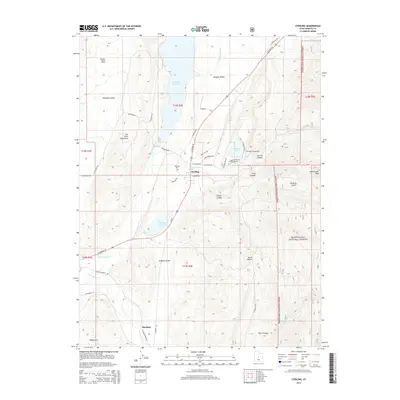
2014 Map of Sterling
USGS Topo · Published 2014About this map
The Sanpete Valley floor serves as a central corridor for water and transit, dominated by the San Pitch River and the engineering of the Gunnison Reservoir. Agriculture and ranching define the local economy, with the Antelope Valley Ranch situated near the San Pitch Mountains and Sterling serving as a primary settlement. To the south, Mayfield sits near the banks of Twelvemile Cr, illustrating the reliance of these desert communities on the narrow riparian ribbons flowing from the high ground.
Find a feature on this map
53 named features on this map. Tap any name to fly to it.
Don’t see what you’re looking for? This feature index may not catch every label — zoom into the map to look around manually.
Map Details
Editions of this 2014 Sterling Map
This is the sole edition of this map. No revisions or reprints were ever made.
Other maps of this area

1885 · Manti
USGS Topo · 1:250,000

1895 · Manti
USGS Topo · 1:250,000

1956 · Price
USGS Topo · 1:250,000

1960 · Price
USGS Topo · 1:250,000

1962 · Price
USGS Topo · 1:250,000
1965 · Woods Lake
USGS Topo · 1:24,000

1965 · Hells Kitchen Canyon SE
USGS Topo · 1:24,000
1965 · Mayfield
USGS Topo · 1:24,000

1965 · Manti
USGS Topo · 1:24,000

1965 · Black Mountain
USGS Topo · 1:24,000