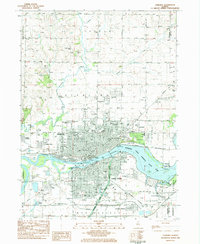
1983 Map of Sterling
USGS Topo · Published 1984About this map
The Rock River corridor defines the twin-city industrial and transportation landscape of Sterling and Rock Falls in the early 1980s. A complex rail network including the Chicago and North Western, Burlington Northern, and Rock Island lines converges along the riverbanks, supporting heavy industry near the Sewage Treatment Plant and various gravel pits. The Hennepin Canal and its associated State Park Parkway offer a distinct engineering contrast to the natural curves of Jordan Creek and Elkhorn Creek to the north. Within the residential blocks, numerous neighborhood assets appear, from Newman Central High Sch to Sinnissippi Park and the Indian Mounds Historic Site. Higher elevations to the north are marked by Science Ridge and several rural cemeteries like Oak Knoll Cem, overlooking the developed river valley below.
Find a feature on this map
76 named features on this map. Tap any name to fly to it.
Don’t see what you’re looking for? This feature index may not catch every label — zoom into the map to look around manually.
Map Details
Editions of this 1983 Sterling Map
2 editions found
Other maps of this area

1930 · Woodsung
USGS Topo · 1:48,000

1932 · Prophetstown
USGS Topo · 1:48,000

1934 · Morrison
USGS Topo · 1:48,000

1936 · Prophetstown
USGS Topo · 1:62,500

1940 · Morrison
USGS Topo · 1:62,500

1946 · Sterling
USGS Topo · 1:62,500

1948 · Sterling
USGS Topo · 1:62,500

1949 · Walnut
USGS Topo · 1:62,500

1958 · Aurora
USGS Topo · 1:250,000

1961 · Aurora
USGS Topo · 1:250,000