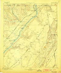
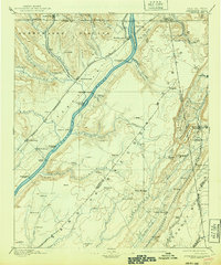
1895 Map of Stevenson
USGS Topo · Published 1901About this map
The Tennessee River winds through this late nineteenth-century landscape, serving as a primary corridor for commerce and transit alongside a dense network of early rail lines. The junction at Stevenson emerges as a vital transportation hub where the Nashville Chattanooga and St. Louis R.R. meets the Memphis and Charleston R.R.. This confluence of infrastructure highlights the strategic importance of the river valley before modern highway development.
Find a feature on this map
105 named features on this map. Tap any name to fly to it.
Don’t see what you’re looking for? This feature index may not catch every label — zoom into the map to look around manually.
Map Details
Editions of this 1895 Stevenson Map
6 editions found

Other maps of this area

1885 · Gadsden
USGS Topo · 1:125,000

1886 · Ringgold
USGS Topo · 1:125,000

1886 · Rome
USGS Topo · 1:125,000

1886 · Stevenson
USGS Topo · 1:125,000

1888 · Gadsden
USGS Topo · 1:125,000

1888 · Chattanooga
USGS Topo · 1:125,000

1888 · Scottsboro
USGS Topo · 1:125,000

1892 · Ringgold
USGS Topo · 1:125,000

1892 · Scottsboro
USGS Topo · 1:125,000

1892 · Stevenson
USGS Topo · 1:125,000