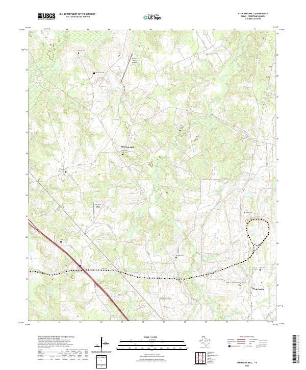
2022 Map of Stewards Mill
USGS Topo · Published 2022About this map
Stewards Mill serves as the focal point of this Freestone County landscape, where family history is deeply etched into the terrain through numerous burial grounds. The area is defined by a dense network of country roads, such as FM 833 and FM 488, connecting scattered homesteads and small settlements like Ward Prairie. The hydrography of the region is dominated by winding waterways including Tehuacana Cr, Cottonwood Cr, and Walnut Cr, which carve through the land and likely influenced the early milling operations that gave the principal settlement its name. Genealogists will find significant value in the distribution of family-named landmarks, ranging from Bonner Cem in the north to Day Cem in the southeast. Modern land use is further indicated by private airstrips like Pyramid Ranch Airport and Moore HX Ranch Airport, reflecting the transition from traditional agricultural foundations to contemporary ranching and rural residential patterns.
Find a feature on this map
53 named features on this map. Tap any name to fly to it.
Don’t see what you’re looking for? This feature index may not catch every label — zoom into the map to look around manually.
Map Details
Editions of this 2022 Stewards Mill Map
This is the sole edition of this map. No revisions or reprints were ever made.
Other maps of this area

1919 · Fairfield
USGS Topo · 1:62,500

1920 · Mexia
USGS Topo · 1:62,500

1954 · Waco
USGS Topo · 1:250,000

1955 · Waco
USGS Topo · 1:250,000

1960 · Winkler
USGS Topo · 1:24,000

1960 · Streetman
USGS Topo · 1:24,000

1960 · Roustabout Camp
USGS Topo · 1:24,000

1961 · Young
USGS Topo · 1:24,000

1963 · Teague North
USGS Topo · 1:24,000

1963 · Kirvin
USGS Topo · 1:24,000