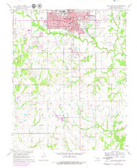
1967 Map of Stillwater South
USGS Topo · Published 1979About this map
Oklahoma State University dominates the northwestern corner of this map, representing a significant era of institutional growth in Stillwater during the 1960s and 1970s. The urban sprawl of Stillwater is marked by a concentration of civic and educational infrastructure, including Westwood Sch, Lincoln Sch, and the local Courthouse. Moving south, the landscape shifts into the rural petroleum and agricultural lands of Elm Grove and Clayton. This area is defined by industrial extraction at the Lost Creek Oil Field and North Perkins Oil Field, where numerous oil wells are scattered across the terrain. Transportation patterns are anchored by the Stillwater and Southern Railroad and the Old Grade, while natural drainage flows through Stillwater Creek and Lost Creek. Cultural landmarks such as Sunset Memorial Gardens and the Drive-in Theater reflect the mid-century social character of the region.
Find a feature on this map
49 named features on this map. Tap any name to fly to it.
Don’t see what you’re looking for? This feature index may not catch every label — zoom into the map to look around manually.
Map Details
Editions of this 1967 Stillwater South Map
2 editions found
Other maps of this area

1893 · Stillwater
USGS Topo · 1:62,500

1908 · Agra
USGS Topo · 1:62,500

1909 · Perkins
USGS Topo · 1:62,500

1929 · Ripley
USGS Topo · 1:62,500

1932 · Ripley
USGS Topo · 1:62,500

1954 · Oklahoma City
USGS Topo · 1:250,000

1955 · Enid
USGS Topo · 1:250,000

1957 · Oklahoma City
USGS Topo · 1:250,000

1958 · Enid
USGS Topo · 1:250,000

1963 · Oklahoma City
USGS Topo · 1:250,000