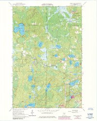
1964 Map of Stingy Lake
USGS Topo · Published 1985About this map
George Washington State Forest and the Sturgeon River State Forest converge in this northern landscape, creating a dense mosaic of woodland and wetlands. The topography is defined by dozens of small kettle lakes and glacial depressions, including the central Lake Twentyfour and the smaller Stuart Lake. A complex hydrography is evident as Day Brook and Deer Brook snake through the terrain, connecting water bodies like Clearwater Lake and Waymier Lake.
Find a feature on this map
24 named features on this map. Tap any name to fly to it.
Don’t see what you’re looking for? This feature index may not catch every label — zoom into the map to look around manually.
Map Details
Editions of this 1964 Stingy Lake Map
4 editions found
Other maps of this area

1951 · Hibbing
USGS Topo · 1:24,000

1952 · Keewatin
USGS Topo · 1:24,000

1952 · Nashwauk
USGS Topo · 1:24,000

1954 · Hibbing
USGS Topo · 1:250,000

1955 · Dewey Lake NW
USGS Topo · 1:24,000

1955 · Dewey Lake
USGS Topo · 1:24,000

1957 · Hibbing
USGS Topo · 1:250,000

1957 · Hibbing
USGS Topo · 1:24,000

1958 · Hibbing
USGS Topo · 1:250,000

1964 · Hibbing
USGS Topo · 1:250,000