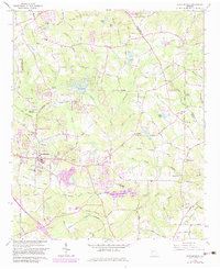
1964 Map of Stockbridge
USGS Topo · Published 1983About this map
Stockbridge serves as the focal point of this survey, situated at the intersection of the Southern railroad and the local road network just as suburban development began to reshape the landscape. The geography is defined by the convergence of Big Cotton Indian Creek and Little Cotton Indian Creek, with the newly established Clayton County Reservoir signaling the area's transition toward modern water infrastructure. Despite these changes, the map preserves a dense record of rural heritage, including early education at Smith-Barnes Sch and numerous family burial grounds such as Knight Cem and English Cem.
Find a feature on this map
49 named features on this map. Tap any name to fly to it.
Don’t see what you’re looking for? This feature index may not catch every label — zoom into the map to look around manually.
Map Details
Editions of this 1964 Stockbridge Map
Other maps of this area

1888 · Atlanta
USGS Topo · 1:125,000

1890 · Atlanta
USGS Topo · 1:125,000

1892 · Atlanta
USGS Topo · 1:125,000

1895 · Atlanta
USGS Topo · 1:125,000

1953 · Atlanta
USGS Topo · 1:250,000

1954 · Conley
USGS Topo · 1:24,000

1954 · Jonesboro
USGS Topo · 1:24,000

1956 · Conyers
USGS Topo · 1:24,000

1956 · Redan
USGS Topo · 1:24,000

1957 · Atlanta
USGS Topo · 1:250,000