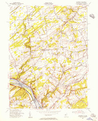
1954 Map of Stockton
USGS Topo · Published 1956About this map
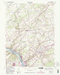
The Delaware River serves as the focal point for this 1950s study of the borderlands between Hunterdon County, New Jersey, and Bucks County, Pennsylvania. The terrain is defined by the winding paths of Wickecheoke Creek and Alexauken Creek, which carve through the landscape toward the river. Near the center of the sheet, the Green Sergeant Covered Bridge remains a prominent landmark, crossing the creek near Sergeantsville. The settlement pattern reflects the agricultural and industrial history of the valley, with compact boroughs like Stockton and Lambertville situated along the Pennsylvania Railroad line.
Find a feature on this map
46 named features on this map. Tap any name to fly to it.
Don’t see what you’re looking for? This feature index may not catch every label — zoom into the map to look around manually.
Map Details
Editions of this 1954 Stockton Map
6 editions found
Other maps of this area

1890 · Easton
USGS Topo · 1:62,500

1890 · High Bridge
USGS Topo · 1:62,500

1890 · Lambertville
USGS Topo · 1:62,500

1890 · Doylestown
USGS Topo · 1:62,500

1891 · Easton
USGS Topo · 1:62,500

1891 · Lambertville
USGS Topo · 1:62,500

1891 · Doylestown
USGS Topo · 1:62,500

1894 · Lambertville
USGS Topo · 1:62,500

1898 · High Bridge
USGS Topo · 1:62,500

1900 · Raritan
USGS Topo · 1:125,000
Featured Places
- Raritan Township, NJ
- Solebury Township, PA
- East Amwell Township, NJ
- West Amwell Township, NJ
- Lambertville, NJ