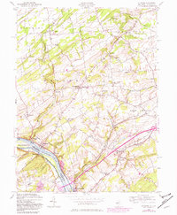
1954 Map of Stockton
USGS Topo · Published 1982About this map
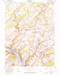
The Delaware River serves as the central artery for this mid-century portrait of the border between New Jersey and Pennsylvania. On the eastern bank, the Delaware and Raritan Canal runs parallel to the water through Stockton, where the industrial legacy of Prallsville and the crossing to Center Bridge are clearly defined. Across the river, the Pennsylvania Canal traces the western shore through Solebury. The landscape is a network of historic rural settlements and crossroads, featuring landmarks like the Green Sergeant Covered Bridge and the Sandy Ridge Ch. The terrain transitions from the river valley up toward Mt Gilboa and the rolling heights of Kingwood and East Amwell. This survey preserves the placement of numerous family-named landmarks and local burial grounds, including the Locktown Cem and Barber Cem, which offer significant value for genealogical research in Hunterdon County.
Find a feature on this map
58 named features on this map. Tap any name to fly to it.
Don’t see what you’re looking for? This feature index may not catch every label — zoom into the map to look around manually.
Map Details
Editions of this 1954 Stockton Map
6 editions found
Other maps of this area

1890 · Easton
USGS Topo · 1:62,500

1890 · High Bridge
USGS Topo · 1:62,500

1890 · Lambertville
USGS Topo · 1:62,500

1890 · Doylestown
USGS Topo · 1:62,500

1891 · Easton
USGS Topo · 1:62,500

1891 · Lambertville
USGS Topo · 1:62,500

1891 · Doylestown
USGS Topo · 1:62,500

1894 · Lambertville
USGS Topo · 1:62,500

1898 · High Bridge
USGS Topo · 1:62,500

1900 · Raritan
USGS Topo · 1:125,000
Featured Places
- Raritan Township, NJ
- Solebury Township, PA
- East Amwell Township, NJ
- West Amwell Township, NJ
- Lambertville, NJ