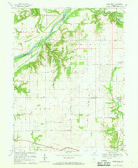
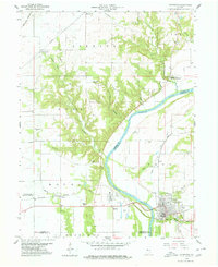
1967 Map of Stone Bluff
USGS Topo · Published 1969About this map
The Wabash River serves as the dominant geographical feature here, carving through the landscape and defining the boundary between Warren and Fountain counties. Along its southern banks, the dramatic sandstone formations of the Portland Arch stand near the settlement of Fountain, where evidence of local industry appears in a nearby Gravel Pit. The map captures a primarily agricultural interior organized by a rigid grid of country roads, such as 400 North Road and 150 North Road, which connect small communities like Stone Bluff and Aylesworth.
Find a feature on this map
50 named features on this map. Tap any name to fly to it.
Don’t see what you’re looking for? This feature index may not catch every label — zoom into the map to look around manually.
Map Details
Editions of this 1967 Stone Bluff Map
This is the sole edition of this map. No revisions or reprints were ever made.
Other maps of this area

1953 · Danville
USGS Topo · 1:250,000

1955 · Danville
USGS Topo · 1:250,000

1956 · Danville
USGS Topo · 1:250,000
1958 · Stonebluff
USGS Topo · 1:24,000
1958 · Veedersburg
USGS Topo · 1:24,000
1958 · Perrysville
USGS Topo · 1:24,000
1958 · Covington
USGS Topo · 1:24,000
1961 · West Lebanon
USGS Topo · 1:24,000
1962 · Williamsport
USGS Topo · 1:24,000
1962 · Mellott
USGS Topo · 1:24,000