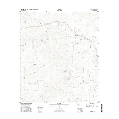
2016 Map of Stoneham
USGS Topo · Published 2016About this map
Stoneham and the surrounding Grimes County landscape are defined by a network of small family cemeteries and seasonal creeks that have shaped this rural Texas community for generations. The map reveals the distribution of early settlements at Yarboro and Whitehall, where the land is carved by drainages like Kickapoo Cr and Beason Cr. These waterways, including Hurricane Cr and Sand Cr, feed into numerous small impoundments such as Yarboro Lake and Koehl Lake, illustrating the local reliance on managed water resources for agriculture and ranching.
Find a feature on this map
94 named features on this map. Tap any name to fly to it.
Don’t see what you’re looking for? This feature index may not catch every label — zoom into the map to look around manually.
Map Details
Editions of this 2016 Stoneham Map
This is the sole edition of this map. No revisions or reprints were ever made.
Other maps of this area

1914 · Navasota
USGS Topo · 1:62,500

1954 · Beaumont
USGS Topo · 1:250,000

1954 · Austin
USGS Topo · 1:250,000

1956 · Hempstead
USGS Topo · 1:62,500

1957 · Beaumont
USGS Topo · 1:250,000

1958 · Navasota
USGS Topo · 1:24,000

1958 · Courtney
USGS Topo · 1:24,000

1960 · Waller NW
USGS Topo · 1:24,000
1961 · Howth
USGS Topo · 1:24,000

1961 · Anderson
USGS Topo · 1:24,000