
1961 Map of Stoneham
USGS Topo · Published 1964About this map
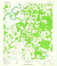
The community of Stoneham serves as a focal point in this 1961 survey, situated at the junction of the Missouri Pacific and the Gulf Colorado And Santa Fe railroads. This intersection, along with nearby Stonehamville, illustrates a landscape deeply tied to the rail economy and the agricultural development of eastern Grimes County. The map reveals a high density of rural institutions, including St Joseph Ch, Harmony Ch, and the Community Center near Whitehall, reflecting a tightly knit network of small farming settlements.
Find a feature on this map
33 named features on this map. Tap any name to fly to it.
Don’t see what you’re looking for? This feature index may not catch every label — zoom into the map to look around manually.
Map Details
Editions of this 1961 Stoneham Map
This is the sole edition of this map. No revisions or reprints were ever made.
Other maps of this area

1914 · Navasota
USGS Topo · 1:62,500

1954 · Beaumont
USGS Topo · 1:250,000

1954 · Austin
USGS Topo · 1:250,000

1956 · Hempstead
USGS Topo · 1:62,500

1957 · Beaumont
USGS Topo · 1:250,000

1958 · Navasota
USGS Topo · 1:24,000

1958 · Courtney
USGS Topo · 1:24,000

1960 · Waller NW
USGS Topo · 1:24,000
1961 · Howth
USGS Topo · 1:24,000

1961 · Anderson
USGS Topo · 1:24,000