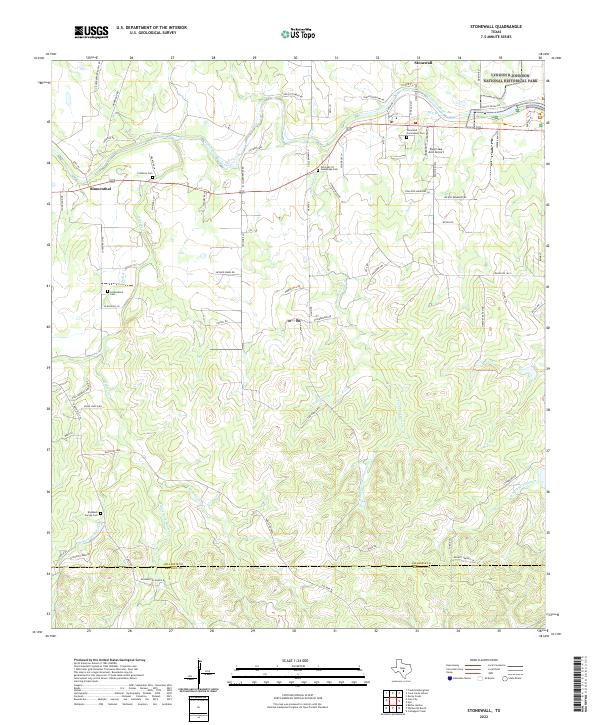
2022 Map of Stonewall
USGS Topo · Published 2022About this map
The Pedernales River carves through the Texas Hill Country in this modern survey of Gillespie County, anchoring the northern reach of the landscape. The river corridor is home to the Lyndon B Johnson National Historical Park, a site of significant national legacy located just east of the settlement of Stonewall. To the west, the community of Blumenthal sits along a network of ranch roads and crossings.
Find a feature on this map
78 named features on this map. Tap any name to fly to it.
Don’t see what you’re looking for? This feature index may not catch every label — zoom into the map to look around manually.
Map Details
Editions of this 2022 Stonewall Map
This is the sole edition of this map. No revisions or reprints were ever made.
Other maps of this area

1894 · Fredericksburg
USGS Topo · 1:125,000

1954 · Llano
USGS Topo · 1:250,000

1955 · Llano
USGS Topo · 1:250,000

1956 · Llano
USGS Topo · 1:250,000

1961 · Stonewall
USGS Topo · 1:24,000

1961 · Hye
USGS Topo · 1:24,000

1961 · Cave Creek School
USGS Topo · 1:24,000

1961 · Rocky Creek
USGS Topo · 1:24,000
1963 · Crabapple Creek
USGS Topo · 1:24,000

1963 · Whitworth Ranch
USGS Topo · 1:24,000