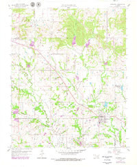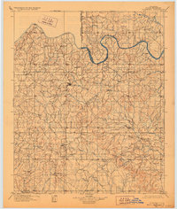
1901 Map of Stonewall
USGS Topo · Published 1928About this map
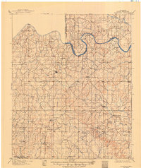
The Oklahoma Indian Territory Boundary Line bisects this landscape, marking a significant administrative division at the close of the nineteenth century. To the north and west lies the Oklahoma Territory, while the east and south remain within the Indian Territory. The winding Canadian River serves as a major geographical anchor, with its northern bank hosting settlements like Sasakwa and Tyrola. The area is characterized by a dense network of watercourses, including Muddy Boggy Creek and the Blue River, which define the drainage patterns across the rolling terrain.
Find a feature on this map
44 named features on this map. Tap any name to fly to it.
Don’t see what you’re looking for? This feature index may not catch every label — zoom into the map to look around manually.
Map Details
Editions of this 1901 Stonewall Map
4 editions found

Historical Maps of Ada Through Time
7 maps found