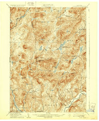
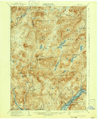
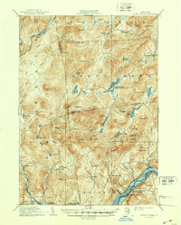
1910 Map of Stony Creek
USGS Topo · Published 1929About this map
The Sacandaga River and its numerous branches dominate this early twentieth-century landscape, carving through high Adirondack peaks and supporting a network of small, isolated settlements. Surveys conducted in 1907 and 1908 reveal the established logging and hunting camps of the era, such as Wadsworth Camp and Buck Mountain Camp, alongside remote post offices like West Stony Creek PO. The terrain is characterized by a dense concentration of small water bodies and wetlands, including Harrisburg Lake, Cotton Swamp, and Mosher Fly, which shaped the early paths and boundaries between Hamilton, Warren, and Saratoga counties.
Find a feature on this map
74 named features on this map. Tap any name to fly to it.
Don’t see what you’re looking for? This feature index may not catch every label — zoom into the map to look around manually.
Map Details
Editions of this 1910 Stony Creek Map
7 editions found

Other maps of this area

1895 · North Creek
USGS Topo · 1:62,500

1897 · North Creek
USGS Topo · 1:62,500

1898 · Thirteenth Lake
USGS Topo · 1:62,500

1899 · Indian Lake
USGS Topo · 1:62,500

1899 · Broadalbin
USGS Topo · 1:62,500

1902 · Broadalbin
USGS Topo · 1:62,500

1902 · Saratoga
USGS Topo · 1:62,500

1902 · Indian Lake
USGS Topo · 1:62,500

1903 · Luzerne
USGS Topo · 1:62,500

1903 · Gloversville
USGS Topo · 1:62,500