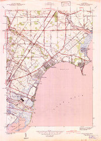
1942 Map of Stony Point
USGS Topo · Published 1942About this map
The Lake Erie shoreline in Frenchtown and Berlin townships is defined by a dense network of drainage canals and coastal resort communities during the early 1940s. Established settlements like Oldport and Brest are surrounded by modern recreational developments including Woodland Beach, Detroit Beach, and Lagoona Beach, which began to transform the marshy lakefront. The landscape is a corridor of heavy transportation, where the Michigan Central and New York Central railroads parallel major arteries like Telegraph Rd.
Find a feature on this map
65 named features on this map. Tap any name to fly to it.
Don’t see what you’re looking for? This feature index may not catch every label — zoom into the map to look around manually.
Map Details
Editions of this 1942 Stony Point Map
2 editions found
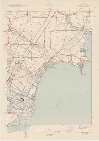
Other maps of this area

1906 · Wyandotte
USGS Topo · 1:62,500

1906 · Romulus
USGS Topo · 1:62,500

1912 · Wyandotte
USGS Topo · 1:62,500

1912 · Monroe
USGS Topo · 1:62,500

1914 · Monroe
USGS Topo · 1:62,500

1927 · Monroe
USGS Topo · 1:31,680

1928 · Romulus
USGS Topo · 1:62,500

1929 · Wyandotte
USGS Topo · 1:62,500

1936 · Rockwood
USGS Topo · 1:31,680

1936 · Stony Point
USGS Topo · 1:31,680
Featured Places
- Frenchtown Charter Township, MI
- Monroe, MI
- Monroe Charter Township, MI
- Berlin Charter Township, MI
- Detroit Beach, Frenchtown Charter Township