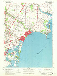
1967 Map of Stony Point
USGS Topo · Published 1969About this map
Lake Erie defines the eastern edge of this Michigan landscape, where the shoreline is punctuated by a mix of residential developments and heavy industrial utility. In the late 1960s, the Enrico Fermi Powerplant stands prominently near Pointe aux Peaux, signaling the era's infrastructure shift alongside leisure destinations like Sterling State Park and the closely packed streets of Woodland Beach and Detroit Beach. Inland, the terrain is a grid of agricultural fields drained by numerous named waterways including Swan Creek and the Malosh Drain.
Find a feature on this map
60 named features on this map. Tap any name to fly to it.
Don’t see what you’re looking for? This feature index may not catch every label — zoom into the map to look around manually.
Map Details
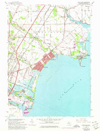
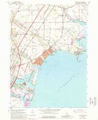
Editions of this 1967 Stony Point Map
3 editions found
Other maps of this area

1906 · Wyandotte
USGS Topo · 1:62,500

1906 · Romulus
USGS Topo · 1:62,500

1912 · Wyandotte
USGS Topo · 1:62,500

1912 · Monroe
USGS Topo · 1:62,500

1914 · Monroe
USGS Topo · 1:62,500

1927 · Monroe
USGS Topo · 1:31,680

1928 · Romulus
USGS Topo · 1:62,500

1929 · Wyandotte
USGS Topo · 1:62,500

1936 · Rockwood
USGS Topo · 1:31,680

1936 · Stony Point
USGS Topo · 1:31,680
Featured Places
- Frenchtown Charter Township, MI
- Monroe, MI
- Monroe Charter Township, MI
- Berlin Charter Township, MI
- Detroit Beach, Frenchtown Charter Township