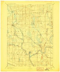
1890 Map of Stoughton
USGS Topo · Published 1908About this map
The Yahara River and Rock River carve through this glacial landscape in southern Wisconsin, anchoring a network of late-nineteenth-century settlements and water-powered industries. During the 1880s survey period, Stoughton and Edgerton emerged as primary hubs along the Chicago Milwaukee and St Paul Railroad, which snakes through the marshes and drumlins of Dane and Rock counties. The map captures smaller hamlets like Dunkirk, Stebbinsville, and Cooksville at a time when local mill sites and rural post offices were the lifeblood of the community. To the north and east, the expansive waters of Lake Kegonsa and Lake Koshkonong define the topography, surrounded by a complex system of creeks such as Koshkonong Creek and Waukoma Creek. This document illustrates the dense township organization of Pleasant Springs, Albion, and Fulton before modern road networks altered the rural landscape.
Find a feature on this map
40 named features on this map. Tap any name to fly to it.
Don’t see what you’re looking for? This feature index may not catch every label — zoom into the map to look around manually.
Map Details
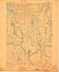
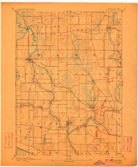
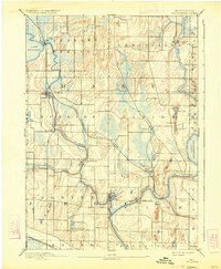
Editions of this 1890 Stoughton Map
6 editions found

Other maps of this area

1889 · Evansville
USGS Topo · 1:62,500

1890 · Madison
USGS Topo · 1:62,500

1890 · Sun Prairie
USGS Topo · 1:62,500

1890 · Stoughton
USGS Topo · 1:62,500

1891 · Waterloo
USGS Topo · 1:62,500

1891 · Koshkonong
USGS Topo · 1:62,500

1891 · Janesville
USGS Topo · 1:62,500

1892 · Madison
USGS Topo · 1:62,500

1893 · Janesville
USGS Topo · 1:62,500

1893 · Brodhead
USGS Topo · 1:62,500