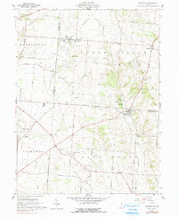
1961 Map of Stoutsville
USGS Topo · Published 1990About this map
The borderlands of Pickaway and Fairfield counties reveal a landscape defined by glacial topography and early transport corridors during the early 1960s. The Pennsylvania Railroad and the Norfolk and Western lines cut through the rolling terrain, supporting the small village of Stoutsville and the settlement at Tarlton. Significant local history is preserved in the numerous family and church burial grounds, including the Maple Hill Cem and Bunker Hill Cem, while the Logan Elm High Sch serves as a central landmark for the rural school districts of the era.
Find a feature on this map
64 named features on this map. Tap any name to fly to it.
Don’t see what you’re looking for? This feature index may not catch every label — zoom into the map to look around manually.
Map Details
Editions of this 1961 Stoutsville Map
3 editions found
Other maps of this area

1906 · Chillicothe
USGS Topo · 1:62,500

1907 · Lancaster
USGS Topo · 1:62,500

1908 · Chillicothe
USGS Topo · 1:62,500

1909 · Lancaster
USGS Topo · 1:62,500

1910 · Laurelville
USGS Topo · 1:62,500

1912 · Laurelville
USGS Topo · 1:62,500

1914 · Circleville
USGS Topo · 1:62,500

1943 · Circleville
USGS Topo · 1:62,500

1944 · Laurelville
USGS Topo · 1:62,500

1947 · Columbus
USGS Topo · 1:250,000