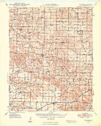
1948 Map of Strafford
USGS Topo · Published 1948About this map
Fair Grove and Strafford anchor this postwar survey of the Missouri Ozarks, where the landscape is defined by a dense network of country schools and rural churches at the convergence of Polk, Dallas, Webster, and Greene counties. The St Louis San Francisco RR cuts across the southern portion of the sheet near Holman, reflecting the vital rail corridor through the region. In the north, the headwaters of the Pomme de Terre River and Little Sac River carve through the terrain, punctuated by local landmarks like Lucas Knob and Red Top Mountain. Genealogy value is significant here, with numerous small burial grounds and congregations such as New Life Cem, Mission Chapel, and Liberty Ch documented. The presence of specialized schools like Hickory Barren Sch and Locust Prairie Sch illustrates the organized rural township structure before mid-century consolidation.
Find a feature on this map
80 named features on this map. Tap any name to fly to it.
Don’t see what you’re looking for? This feature index may not catch every label — zoom into the map to look around manually.
Map Details
Editions of this 1948 Strafford Map
2 editions found

Other maps of this area

1884 · Springfield
USGS Topo · 1:125,000

1884 · Bolivar
USGS Topo · 1:125,000

1886 · Springfield
USGS Topo · 1:125,000

1892 · Bolivar
USGS Topo · 1:125,000

1935 · Springfield
USGS Topo · 1:24,000

1937 · Galloway
USGS Topo · 1:24,000

1937 · Ozark
USGS Topo · 1:48,000

1939 · Fordland
USGS Topo · 1:62,500

1939 · Long Lane
USGS Topo · 1:62,500

1942 · Fordland
USGS Topo · 1:62,500