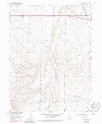
1955 Map of Strasburg NW
USGS Topo · Published 1986About this map
Kiowa Creek and West Sand Creek carve through this high plains landscape of the Colorado interior, reflecting a mid-century agricultural and utility infrastructure. The terrain is defined by its water management and transit corridors, notably featuring the Union Pacific rail line and the historic Old Victory Highway cutting across the northern reaches near the boundary of Adams Co and Arapahoe Co. The map reveals a working landscape dotted with numerous Windmills, essential for sustaining life and livestock in this arid region.
Find a feature on this map
12 named features on this map. Tap any name to fly to it.
Don’t see what you’re looking for? This feature index may not catch every label — zoom into the map to look around manually.
Map Details
Editions of this 1955 Strasburg NW Map
4 editions found
Other maps of this area

1890 · East Denver
USGS Topo · 1:125,000

1949 · Bennett
USGS Topo · 1:24,000

1950 · Roper School
USGS Topo · 1:24,000

1951 · Roper School
USGS Topo · 1:24,000

1951 · Manila
USGS Topo · 1:24,000

1953 · Denver
USGS Topo · 1:250,000

1954 · Watkins
USGS Topo · 1:24,000

1955 · Strasburg NW
USGS Topo · 1:24,000

1955 · Watkins SE
USGS Topo · 1:24,000

1955 · Strasburg
USGS Topo · 1:24,000