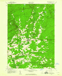
1945 Map of Stratford
USGS Topo · Published 1960About this map
East Canada Creek carves a deep valley through this mid-1940s landscape, serving as a geographic anchor for the rural communities of Stratford and Emmonsburg. The terrain is defined by the heavy timber of Adirondack State Park, where the boundary between Herkimer and Fulton counties follows the rugged uplands. Settlement is clustered along valley roads, marked by local institutions such as School No 10 and the Roundtop Cem east of the main village.
Find a feature on this map
26 named features on this map. Tap any name to fly to it.
Don’t see what you’re looking for? This feature index may not catch every label — zoom into the map to look around manually.
Map Details
Editions of this 1945 Stratford Map
4 editions found
Other maps of this area

1900 · Little Falls
USGS Topo · 1:62,500

1900 · Wilmurt
USGS Topo · 1:62,500

1901 · Lassellsville
USGS Topo · 1:62,500

1902 · Wilmurt
USGS Topo · 1:62,500

1903 · Lassellsville
USGS Topo · 1:62,500

1903 · Little Falls
USGS Topo · 1:62,500

1904 · Piseco Lake
USGS Topo · 1:62,500

1906 · Piseco Lake
USGS Topo · 1:62,500

1908 · Piseco Lake
USGS Topo · 1:62,500

1939 · Little Falls
USGS Topo · 1:62,500