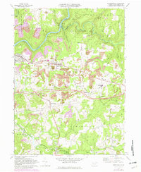
1968 Map of Strattanville
USGS Topo · Published 1982About this map
The Clarion River snakes through the northern hills of this quadrangle, flanked by the sprawling State Game Lands No 74 and State Game Lands No 72. In the late 1960s, this region was a landscape defined by resource extraction and modernization, visible in the numerous Strip Mines that dot the terrain around Strattanville and the expansive Gas Field occupying the southern portions of the map. The construction of Interchange 10 marks a significant shift in local transportation, cutting across the older rural network of Mechanicsville and Waterson.
Find a feature on this map
50 named features on this map. Tap any name to fly to it.
Don’t see what you’re looking for? This feature index may not catch every label — zoom into the map to look around manually.
Map Details
Editions of this 1968 Strattanville Map
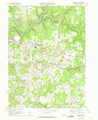
2 editions found
Other maps of this area

1906 · Clarion
USGS Topo · 1:62,500

1907 · Clarion
USGS Topo · 1:62,500

1918 · Loleta
USGS Topo · 1:62,500

1922 · Tionesta
USGS Topo · 1:62,500

1924 · Tionesta
USGS Topo · 1:62,500

1924 · Brookville
USGS Topo · 1:62,500

1926 · Brookville
USGS Topo · 1:62,500

1936 · Marienville
USGS Topo · 1:48,000

1941 · Marienville
USGS Topo · 1:62,500

1944 · Brookville
USGS Topo · 1:62,500