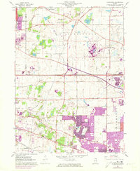
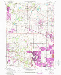
1961 Map of Streamwood
USGS Topo · Published 1973About this map
Streamwood and the surrounding townships of Barrington, Hanover, and Schaumburg are shown during a significant period of suburban transition. The landscape preserves a mix of rural heritage and rapid development, visible in the proximity of New Era Sch and Union Cem to new residential extensions. The Northwest Tollway cuts through the center, accelerating the growth of communities like South Barrington and Hanover Park.
Find a feature on this map
61 named features on this map. Tap any name to fly to it.
Don’t see what you’re looking for? This feature index may not catch every label — zoom into the map to look around manually.
Map Details
Editions of this 1961 Streamwood Map
5 editions found
Other maps of this area

1908 · Wheaton
USGS Topo · 1:62,500

1923 · Barrington
USGS Topo · 1:62,500

1925 · Elgin
USGS Topo · 1:62,500

1932 · Geneva
USGS Topo · 1:62,500

1935 · Barrington
USGS Topo · 1:62,500

1940 · Elgin
USGS Topo · 1:62,500

1948 · Wheaton
USGS Topo · 1:62,500

1948 · Geneva
USGS Topo · 1:62,500

1949 · Geneva
USGS Topo · 1:24,000

1953 · West Chicago
USGS Topo · 1:24,000