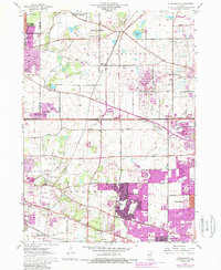
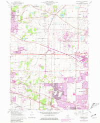
1961 Map of Streamwood
USGS Topo · Published 1989About this map
Streamwood and the surrounding townships of Barrington and Hanover are captured during a period of rapid suburban expansion in the mid-20th century. The 1961 base topography is layered with purple photorevisions from 1972 and 1978, illustrating the dramatic conversion of farmland and gravel pits into residential developments. While newer neighborhoods push south and east, the landscape retains older landmarks such as Barrington Center and the New Era Sch.
Find a feature on this map
59 named features on this map. Tap any name to fly to it.
Don’t see what you’re looking for? This feature index may not catch every label — zoom into the map to look around manually.
Map Details
Editions of this 1961 Streamwood Map
5 editions found
Other maps of this area

1908 · Wheaton
USGS Topo · 1:62,500

1923 · Barrington
USGS Topo · 1:62,500

1925 · Elgin
USGS Topo · 1:62,500

1932 · Geneva
USGS Topo · 1:62,500

1935 · Barrington
USGS Topo · 1:62,500

1940 · Elgin
USGS Topo · 1:62,500

1948 · Wheaton
USGS Topo · 1:62,500

1948 · Geneva
USGS Topo · 1:62,500

1949 · Geneva
USGS Topo · 1:24,000

1953 · West Chicago
USGS Topo · 1:24,000