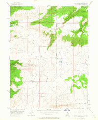
1955 Map of Stuntz Reservoir
USGS Topo · Published 1964About this map
Dinosaur National Monument dominates the northern expanse of this mid-century survey, where the high desert terrain of the Utah-Colorado border is defined by prominent geological formations like Ruple Ridge and Stuntz Ridge. The landscape reflects a history of isolated homesteading and ranching, evidenced by the scattered presence of remote shelters such as the Douglas Chew Cabin, Harland Cabin, and Wilkins Cabin.
Find a feature on this map
25 named features on this map. Tap any name to fly to it.
Don’t see what you’re looking for? This feature index may not catch every label — zoom into the map to look around manually.
Map Details
Editions of this 1955 Stuntz Reservoir Map
2 editions found
Other maps of this area

1885 · Ashley
USGS Topo · 1:250,000

1907 · Rangely
USGS Topo · 1:125,000

1907 · Jensen
USGS Topo · 1:125,000

1910 · Jensen
USGS Topo · 1:125,000

1910 · Rangely
USGS Topo · 1:125,000

1954 · Hells Canyon
USGS Topo · 1:24,000

1954 · Canyon of Lodore South
USGS Topo · 1:24,000

1954 · Vernal
USGS Topo · 1:250,000

1955 · Island Park
USGS Topo · 1:24,000

1955 · Stuntz Reservoir
USGS Topo · 1:24,000