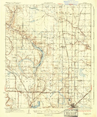
1937 Map of Stuttgart
USGS Topo · Published 1937About this map
Stuttgart serves as the focal point of this 1930s survey, situated at the intersection of the St Louis Southwestern Railway and the Chicago Rock Island and Pacific lines. The landscape is defined by the transition from the Grand Prairie into the meandering wetlands of La Grue Bayou and Two Prairie Bayou. Settlement patterns are distinctly tied to the rail corridors, where small junctions like Rice Junction and Fairmount Station supported the region's agricultural economy.
Find a feature on this map
64 named features on this map. Tap any name to fly to it.
Don’t see what you’re looking for? This feature index may not catch every label — zoom into the map to look around manually.
Map Details
Editions of this 1937 Stuttgart Map
3 editions found
Other maps of this area

1935 · Altheimer
USGS Topo · 1:62,500

1935 · Hazen
USGS Topo · 1:62,500

1935 · Clarendon
USGS Topo · 1:62,500

1937 · Stuttgart
USGS Topo · 1:62,500

1937 · England
USGS Topo · 1:48,000

1939 · Stuttgart
USGS Topo · 1:62,500

1940 · Lonoke
USGS Topo · 1:62,500

1941 · Hazen
USGS Topo · 1:62,500

1941 · De Witt
USGS Topo · 1:62,500

1941 · De Valls Bluff
USGS Topo · 1:62,500