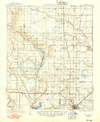
1937 Map of Stuttgart
USGS Topo · Published 1949About this map
Stuttgart anchors the southern edge of this survey, serving as a vital hub for the region's burgeoning rice industry and rail transport during the 1930s. The landscape is defined by its drainage and irrigation networks, with La Grue Bayou and Two Prairie Bayou winding through the flatlands. The intersection of the St Louis Southwestern and Chicago Rock Island and Pacific railroads created critical shipping points like Rice Junction and Fairmount Sta, essential for moving local harvests.
Find a feature on this map
68 named features on this map. Tap any name to fly to it.
Don’t see what you’re looking for? This feature index may not catch every label — zoom into the map to look around manually.
Map Details
Editions of this 1937 Stuttgart Map
3 editions found
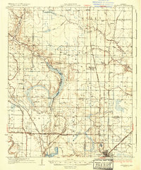
Other maps of this area

1935 · Altheimer
USGS Topo · 1:62,500

1935 · Hazen
USGS Topo · 1:62,500

1935 · Clarendon
USGS Topo · 1:62,500

1937 · Stuttgart
USGS Topo · 1:62,500

1937 · England
USGS Topo · 1:48,000

1939 · Stuttgart
USGS Topo · 1:62,500

1940 · Lonoke
USGS Topo · 1:62,500

1941 · Hazen
USGS Topo · 1:62,500

1941 · De Witt
USGS Topo · 1:62,500

1941 · De Valls Bluff
USGS Topo · 1:62,500