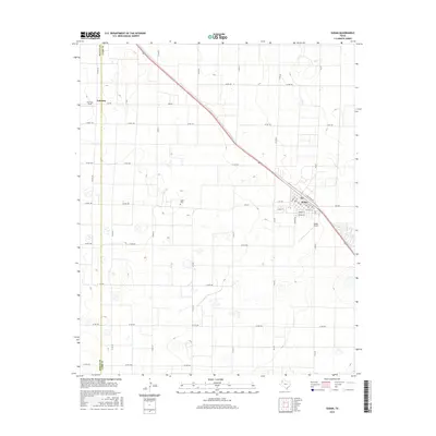
2016 Map of Sudan
USGS Topo · Published 2016About this map
Agricultural lands in Lamb County and Bailey County define this landscape, centered on the settlement of Sudan. The town's grid is clearly visible, showing a network of streets including Main St, Temple St, and E 3rd Ave. Located just northwest of the main town center, the Sudan Cem provides a point of interest for genealogists, while the nearby Sudan Airport and Fairview Field north of Fairview indicate the importance of aviation to this rural region. The topography is marked by numerous depressions and wetlands typical of the Texas Panhandle, intersected by a straight diagonal rail line and a rigid grid of county roads such as Co RD 55 and Co RD 65 that partition the surrounding ranch and farm acreage.
Find a feature on this map
44 named features on this map. Tap any name to fly to it.
Don’t see what you’re looking for? This feature index may not catch every label — zoom into the map to look around manually.
Map Details
Editions of this 2016 Sudan Map
This is the sole edition of this map. No revisions or reprints were ever made.
Other maps of this area

1954 · Clovis
USGS Topo · 1:250,000

1954 · Brownfield
USGS Topo · 1:250,000

1958 · Brownfield
USGS Topo · 1:250,000

1958 · Clovis
USGS Topo · 1:250,000

1962 · Brownfield
USGS Topo · 1:250,000

1962 · Muleshoe
USGS Topo · 1:24,000

1962 · Needmore
USGS Topo · 1:24,000

1962 · Amherst
USGS Topo · 1:24,000

1962 · Sudan
USGS Topo · 1:24,000

1962 · Muleshoe NE
USGS Topo · 1:24,000