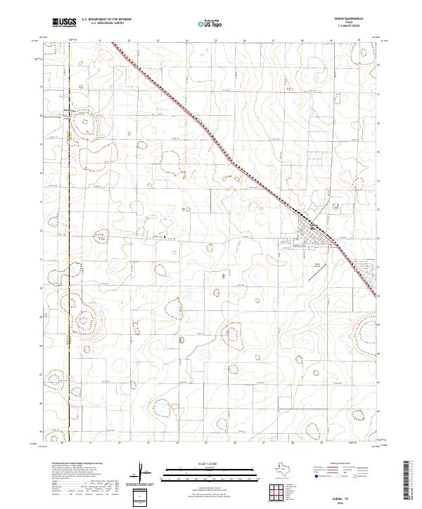
2022 Map of Sudan
USGS Topo · Published 2022About this map
The town of Sudan serves as the central hub of this agricultural landscape in Lamb Co, situated along a prominent diagonal highway corridor. The town's grid is well-defined, featuring streets such as Main St, Temple St, and Hornet Dr, indicating a settled community structure. Just outside the main town site, Sudan Airport and the Sudan Cem provide key markers for local history and infrastructure. To the northwest, the settlement of Fairview and the nearby Fairview Field sit right at the Bailey Co line. The terrain is characterized by a dense network of county roads, including Co Rd 178 and Co Rd 208, which divide the high plains into a precise geometric pattern of land use.
Find a feature on this map
44 named features on this map. Tap any name to fly to it.
Don’t see what you’re looking for? This feature index may not catch every label — zoom into the map to look around manually.
Map Details
Editions of this 2022 Sudan Map
This is the sole edition of this map. No revisions or reprints were ever made.
Other maps of this area

1954 · Clovis
USGS Topo · 1:250,000

1954 · Brownfield
USGS Topo · 1:250,000

1958 · Brownfield
USGS Topo · 1:250,000

1958 · Clovis
USGS Topo · 1:250,000

1962 · Brownfield
USGS Topo · 1:250,000

1962 · Muleshoe
USGS Topo · 1:24,000

1962 · Needmore
USGS Topo · 1:24,000

1962 · Amherst
USGS Topo · 1:24,000

1962 · Sudan
USGS Topo · 1:24,000

1962 · Muleshoe NE
USGS Topo · 1:24,000