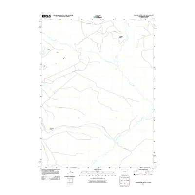
2011 Map of Sugarloaf Butte
USGS Topo · Published 2011About this map
Offield Place sits along the meandering path of Vermillion Creek in this northern Moffat County landscape near the Wyoming border. The terrain is defined by an intricate network of drainage systems and high desert features, most notably the prominent landmark of Sugarloaf Butte to the west. This 2011 survey documents a sparsely settled region where transportation is limited to established routes like County Rd-63 and County Rd-4. Water is a critical geographic marker here, with the confluence of Canyon Creek and Vermillion Creek, alongside isolated basins such as Fonce Lake and G Lake. Broad alluvial features like Fonce Flat and Fonce Wash illustrate the erosional character of the high plains. The map also traces the significant course of Talamantes Creek, known here as Talamantes Crk, which cuts through the southern portion of the quadrangle.
Find a feature on this map
14 named features on this map. Tap any name to fly to it.
Don’t see what you’re looking for? This feature index may not catch every label — zoom into the map to look around manually.
Map Details
Editions of this 2011 Sugarloaf Butte Map
This is the sole edition of this map. No revisions or reprints were ever made.
Other maps of this area

1954 · Vernal
USGS Topo · 1:250,000

1954 · Rock Springs
USGS Topo · 1:250,000

1958 · Vernal
USGS Topo · 1:250,000

1958 · Rock Springs
USGS Topo · 1:250,000

1960 · Vernal
USGS Topo · 1:250,000

1962 · Rock Springs
USGS Topo · 1:250,000

1963 · Scrivner Butte
USGS Topo · 1:24,000

1966 · G Spring
USGS Topo · 1:24,000

1966 · Sugarloaf Butte
USGS Topo · 1:24,000

1966 · Big Joe Basin
USGS Topo · 1:24,000