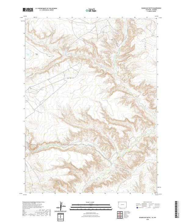
2022 Map of Sugarloaf Butte
USGS Topo · Published 2022About this map
Sugarloaf Butte rises as a prominent landmark in this corner of Moffat County, where the high desert terrain is defined by deep drainages and isolated water sources. The landscape is carved by the winding paths of Talamantes Creek, Vermillion Cr, and Canyon Cr, which dictate the movement across this arid territory. Human activity is sparse and primarily limited to the periphery, with Co Rd 4 and Co Rd 10N providing the only primary access through the region. Small, distinctive water features like Fonce Lake and the curiously named G Lake serve as critical points for local geography. The presence of Fonce Flat suggests the varying elevations that characterize this portion of the Colorado-Wyoming borderlands, a region traditionally used for open-range grazing and resource management.
Find a feature on this map
14 named features on this map. Tap any name to fly to it.
Don’t see what you’re looking for? This feature index may not catch every label — zoom into the map to look around manually.
Map Details
Editions of this 2022 Sugarloaf Butte Map
This is the sole edition of this map. No revisions or reprints were ever made.
Other maps of this area

1954 · Vernal
USGS Topo · 1:250,000

1954 · Rock Springs
USGS Topo · 1:250,000

1958 · Vernal
USGS Topo · 1:250,000

1958 · Rock Springs
USGS Topo · 1:250,000

1960 · Vernal
USGS Topo · 1:250,000

1962 · Rock Springs
USGS Topo · 1:250,000

1963 · Scrivner Butte
USGS Topo · 1:24,000

1966 · G Spring
USGS Topo · 1:24,000

1966 · Sugarloaf Butte
USGS Topo · 1:24,000

1966 · Big Joe Basin
USGS Topo · 1:24,000