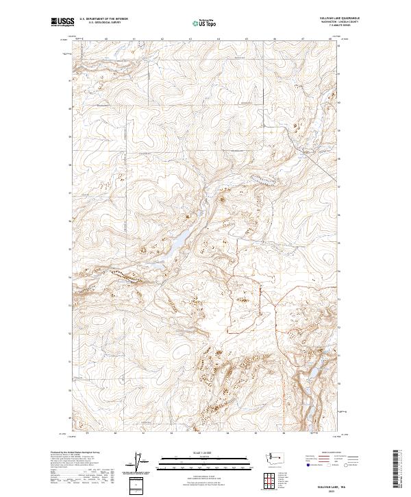
2023 Map of Sullivan Lake
USGS Topo · Published 2023About this map
Little Sullivan Lake and a series of smaller seasonal water bodies define the interior of this Lincoln County landscape. The topography is marked by significant drainages such as Canniwai Creek in the north and Lake Creek in the southeast, which feeds into Bobs Lakes. This rural expanse is crisscrossed by a network of established section roads, many bearing local family names like Schorzman Rd, Zimbleman Rd, and Kuch Rd, suggesting a history of agricultural settlement and land ownership. The presence of named water sources like Waukesha Spring and Water Falls Spring indicates the critical role of reliable water in this dry terrain. The southern portion of the quadrangle is punctuated by Marlin Hollow, while larger pools like Bulgarians Lake and Webley Lake appear as central landmarks in an otherwise open, undulating territory.
Find a feature on this map
27 named features on this map. Tap any name to fly to it.
Don’t see what you’re looking for? This feature index may not catch every label — zoom into the map to look around manually.
Map Details
Editions of this 2023 Sullivan Lake Map
This is the sole edition of this map. No revisions or reprints were ever made.
Other maps of this area

1953 · Ritzville
USGS Topo · 1:250,000

1959 · Ritzville
USGS Topo · 1:250,000

1965 · Ritzville
USGS Topo · 1:250,000

1968 · Marlin SW
USGS Topo · 1:24,000

1968 · Irby
USGS Topo · 1:24,000

1968 · Marlin
USGS Topo · 1:24,000

1968 · Pacific Lake
USGS Topo · 1:24,000
1968 · Odessa
USGS Topo · 1:24,000

1968 · Sullivan Lake
USGS Topo · 1:24,000

1969 · Almira SE
USGS Topo · 1:24,000