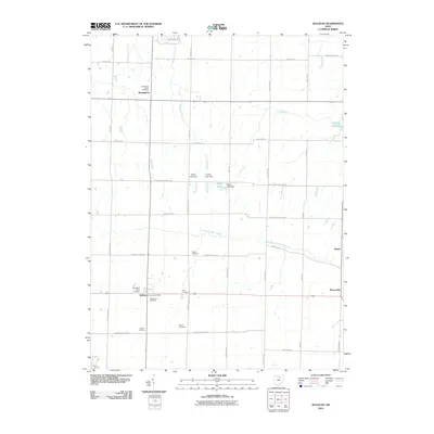
2010 Map of Sullivan
USGS Topo · Published 2010About this map
Sullivan and its surrounding agricultural townships appear in this detailed 2010 survey, showcasing a landscape defined by small crossroads settlements and the waters of the East Branch Black River. The area is notably dense with family and community burial grounds, including the Rice Cemetery, Gould Cemetery, and Huntington Center Cemetery, which offer valuable locations for genealogical research. To the north, the boundary of Findley State Park meets the headwaters of Wellington Creek, while the rural interior is punctuated by several small reservoirs and dams, such as Taylor Lake and the Spencer Reservoir. This map documents the persistent rural character of North Central Ohio, where historical townships maintain their identity through these scattered hamlets like Homer and Homerville and the steady network of roads like Clark Rd and New London Eastern Rd.
Find a feature on this map
44 named features on this map. Tap any name to fly to it.
Don’t see what you’re looking for? This feature index may not catch every label — zoom into the map to look around manually.
Map Details
Editions of this 2010 Sullivan Map
This is the sole edition of this map. No revisions or reprints were ever made.
Other maps of this area

1904 · Wellington
USGS Topo · 1:62,500

1906 · Wellington
USGS Topo · 1:62,500

1906 · West Salem
USGS Topo · 1:62,500

1908 · Ashland
USGS Topo · 1:62,500

1908 · West Salem
USGS Topo · 1:62,500

1908 · New London
USGS Topo · 1:62,500

1950 · Marion
USGS Topo · 1:250,000

1956 · Toledo
USGS Topo · 1:250,000
1960 · Wellington
USGS Topo · 1:24,000

1960 · Nova
USGS Topo · 1:24,000