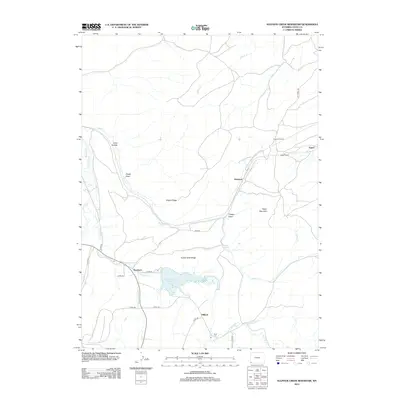
2012 Map of Sulphur Creek Reservoir
USGS Topo · Published 2012About this map
Sulphur Creek Reservoir and the high-elevation corridors of Uinta County define this 2012 survey, where the infrastructure of the American West meets the high plains. The settlement of Beartown sits just west of the reservoir, while the rail-oriented locales of Altamont and Aspen mark the northern reaches of the quadrangle. These names are tied to the transcontinental rail history of the region, specifically evidenced by the Altamont Tunnel and Aspen Tunnel, which pierce the ridges to maintain a steady grade for the railroad.
Find a feature on this map
33 named features on this map. Tap any name to fly to it.
Don’t see what you’re looking for? This feature index may not catch every label — zoom into the map to look around manually.
Map Details
Editions of this 2012 Sulphur Creek Reservoir Map
This is the sole edition of this map. No revisions or reprints were ever made.
Other maps of this area

1954 · Ogden
USGS Topo · 1:250,000

1958 · Ogden
USGS Topo · 1:250,000

1960 · Ogden
USGS Topo · 1:250,000

1965 · Evanston
USGS Topo · 1:24,000

1965 · Ragan
USGS Topo · 1:24,000

1965 · Myers Reservoir
USGS Topo · 1:24,000

1965 · Sulphur Creek Reservoir
USGS Topo · 1:24,000

1965 · Guild Hollow
USGS Topo · 1:24,000
1965 · Pine Knoll
USGS Topo · 1:24,000
1965 · Moslander Reservoir
USGS Topo · 1:24,000