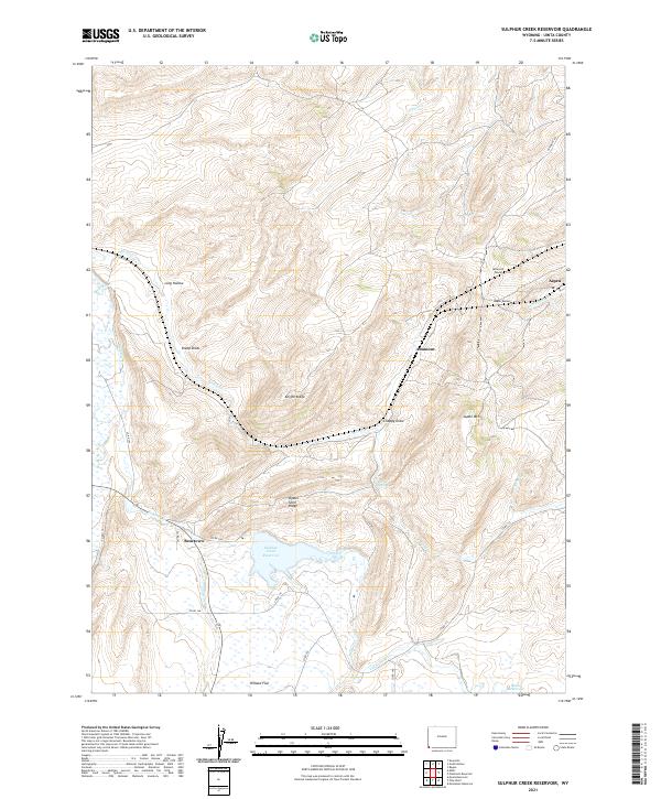
2021 Map of Sulphur Creek Reservoir
USGS Topo · Published 2021About this map
Sulphur Creek Reservoir dominates the lower central portion of this Uinta County landscape, where the waters of Sulphur Cr and LaChapelle Cr are impounded. The terrain is characterized by a series of north-south running ridges and draws, most notably Knight Ridge and the descriptively named Oyster Shell Ridge. These geological formations dictated the path of regional infrastructure, visible in the alignment of the Altamont Tunnel and Aspen Tunnel as they pierce the high ground near Aspen Mtn.
Find a feature on this map
38 named features on this map. Tap any name to fly to it.
Don’t see what you’re looking for? This feature index may not catch every label — zoom into the map to look around manually.
Map Details
Editions of this 2021 Sulphur Creek Reservoir Map
This is the sole edition of this map. No revisions or reprints were ever made.
Other maps of this area

1954 · Ogden
USGS Topo · 1:250,000

1958 · Ogden
USGS Topo · 1:250,000

1960 · Ogden
USGS Topo · 1:250,000

1965 · Evanston
USGS Topo · 1:24,000

1965 · Ragan
USGS Topo · 1:24,000

1965 · Myers Reservoir
USGS Topo · 1:24,000

1965 · Sulphur Creek Reservoir
USGS Topo · 1:24,000

1965 · Guild Hollow
USGS Topo · 1:24,000
1965 · Pine Knoll
USGS Topo · 1:24,000
1965 · Moslander Reservoir
USGS Topo · 1:24,000