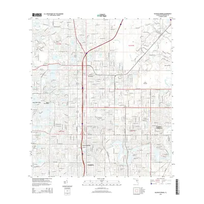
2015 Map of Sulphur Springs
USGS Topo · Published 2015About this map
Sulphur Springs and the surrounding northern Tampa suburbs appear in high detail in this modern survey, revealing an intricate landscape of residential development woven around numerous sinkhole lakes. The density of water bodies, including Lake Magdalene, Lake Carroll, and Platt Lake, highlights the distinctive karst topography of the region. This era shows the extensive footprint of the Univ of S Florida and the established city of Temple Terrace alongside older community names like Nowatney and Vera Place.
Find a feature on this map
226 named features on this map. Tap any name to fly to it.
Don’t see what you’re looking for? This feature index may not catch every label — zoom into the map to look around manually.
Map Details
Editions of this 2015 Sulphur Springs Map
This is the sole edition of this map. No revisions or reprints were ever made.
Other maps of this area

1921 · Tampa
USGS Topo · 1:62,500

1921 · St Petersburg
USGS Topo · 1:62,500

1943 · Gandy Bridge
USGS Topo · 1:31,680

1943 · Odessa
USGS Topo · 1:24,000

1943 · Thonotosassa
USGS Topo · 1:24,000

1943 · Lutz
USGS Topo · 1:24,000

1944 · Sulphur Springs
USGS Topo · 1:31,680

1944 · Mango
USGS Topo · 1:31,680

1944 · Tampa
USGS Topo · 1:31,680

1944 · Wesley Chapel
USGS Topo · 1:31,680